Layers of the island
Geology

Layers of the island

Malta is built from five layers of rock laid down in an ancient sea. Each one shapes the landscape, the buildings and the life above it.

Explore the rock layers →

The five rock layers

Choose a layer, from the youngest at the top to the oldest at the bottom. Swipe along the bar on a phone.

Globigerina Limestone

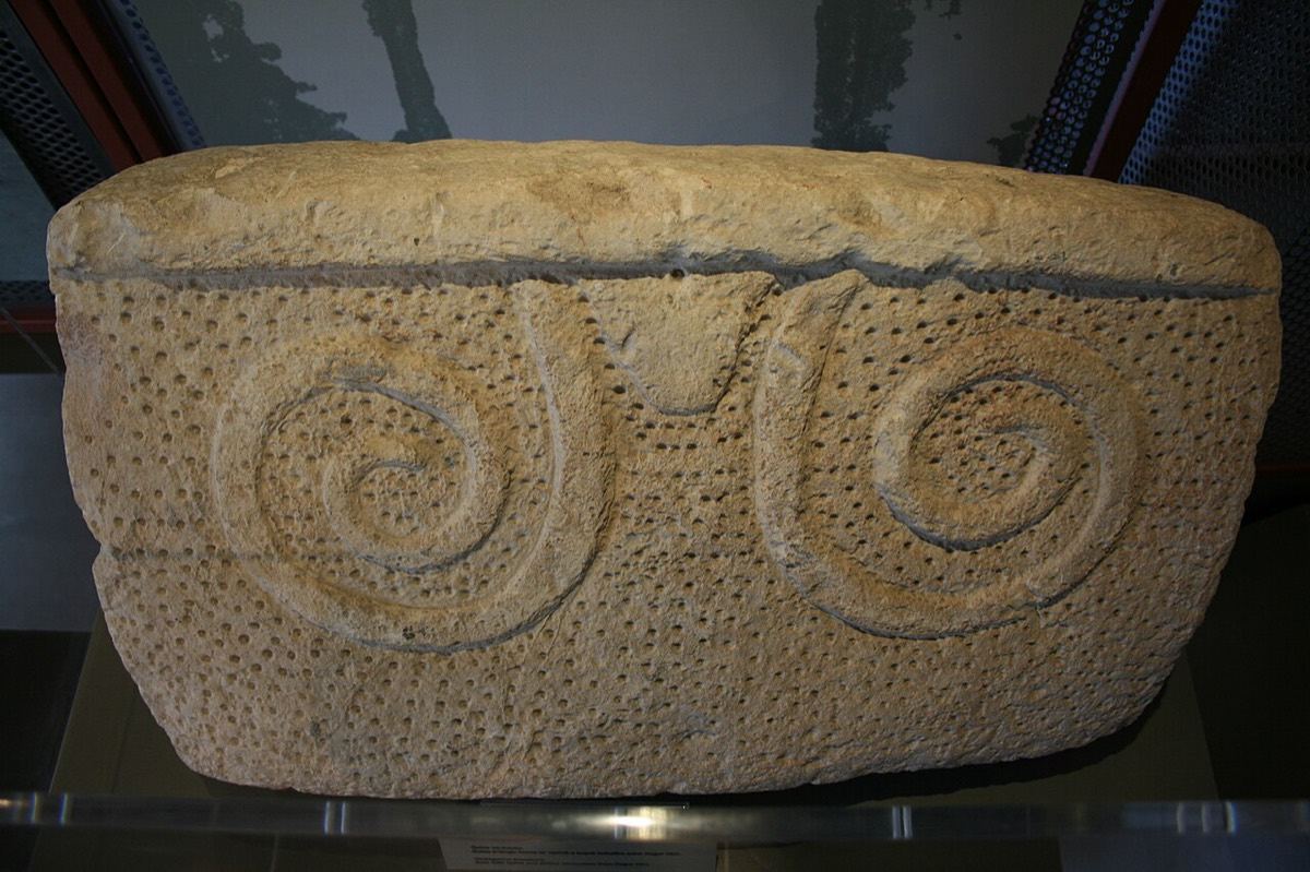
Temple block carved from Globigerina Limestone
Temple block carved from Globigerina Limestone. Photo: A,Ocram, CC0

Yellow to pale-grey limestone made of the shells of tiny floating sea creatures, laid down in deeper water than the coralline layers. It covers about 70% of the islands and wears down into gently rolling countryside. This is franka, the honey-coloured building stone of Malta's temples, churches and towns.

Thickness
23 m near Fort Chambray, Gozo, to 207 m around Marsaxlokk
Covers
About 70% of the islands

Born under the sea

All five rock layers began as limy mud and sand on the seabed between about 30 and 5 million years ago, in the Oligocene and Miocene. The future islands lay far from any coast, so almost nothing washed in from land: the rocks are made mainly of the shells and skeletons of sea creatures and algae. They lie stacked like a layer cake, oldest at the bottom.

The islands only rose above the sea much later, in the Quaternary period, the last 2.6 million years.

Water in the rock

Malta's fresh water comes from its rocks. Rain soaks down through the porous limestone until it meets the Blue Clay, which water cannot pass through. There it forms "perched" groundwater, which seeps out as springs along the hillsides. Deeper down, rain that reaches the Lower Coralline Limestone floats on salty sea water as a lens of fresh water at sea level, the islands' main groundwater store.

Cliffs and caves

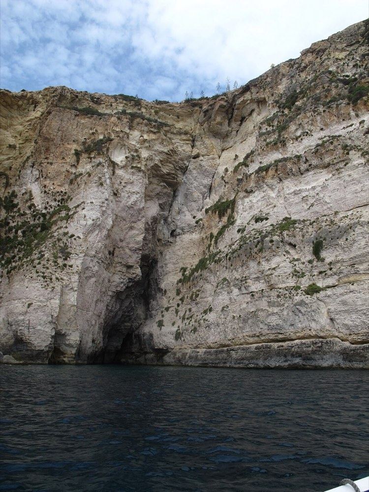
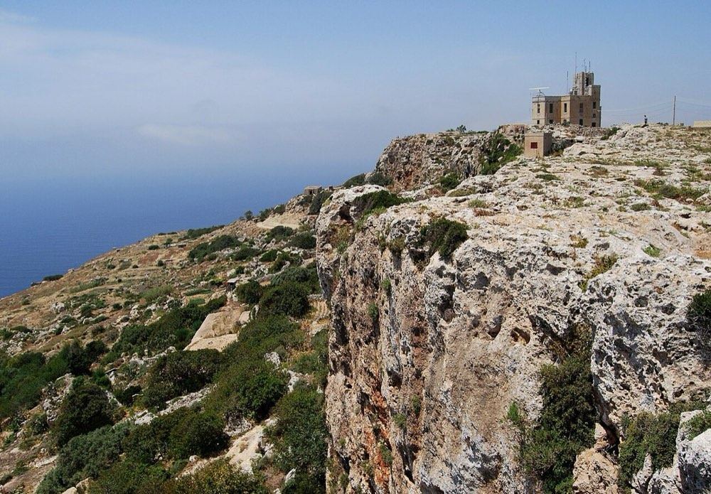
The hard Lower Coralline Limestone forms the sheer sea cliffs of Dingli and the south-west coast, and the caves and arches carved by the waves.

Building stone

Globigerina Limestone (franka) is soft when first quarried and hardens in the air. It gives Valletta, Mdina, the prehistoric temples and village churches their warm honey colour, and was once exported for building abroad.

After the islands rose

Once the land was above water, new deposits built up on top of the five layers: tufa from springs, rock debris on slopes, river sediment in the valleys, old buried soils, wind-blown silt, and material filling caves and cracks. Cave deposits such as those at Għar Dalam hold bones of animals that once lived here, including dwarf elephants and hippos.

The Azure Window

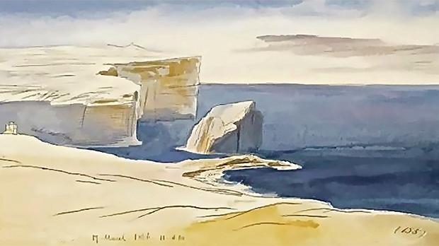
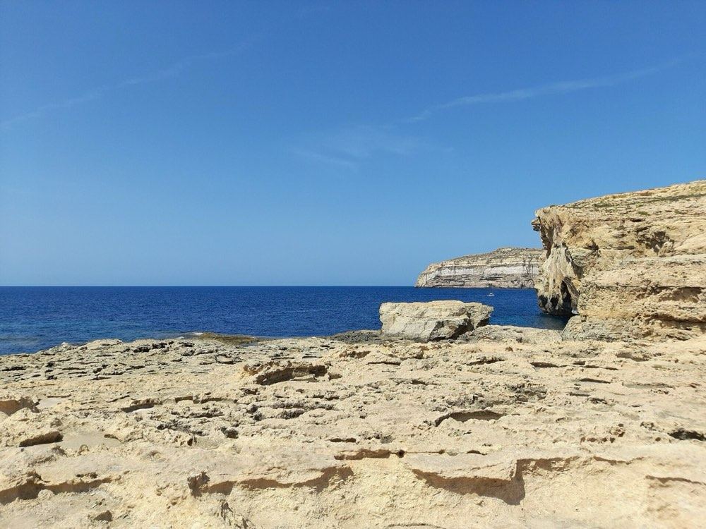
Gozo's famous limestone arch at Dwejra collapsed into the sea during a storm in March 2017, a reminder that the coast is always changing.

Source: Environment and Resources Authority, Maltese Geology.
From space

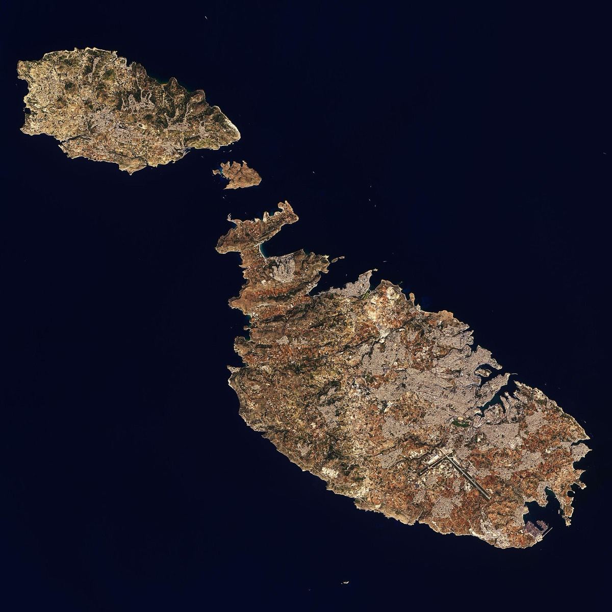
Seen from a satellite, the islands are the colour of their rock. The yellow-grey is limestone: bare ground, quarries, and the towns built from it. The north of Malta is a run of ridges and valleys all pointing the same way, the work of faults (see below). The high, cliffed coast faces south-west; the drowned valleys that make Malta's harbours open to the north-east, because the islands tilt gently that way.

Satellite view of Gozo, Comino and Malta
Gozo, Comino and Malta from Landsat 9, 27 October 2022. Image: NASA Earth Observatory (Joshua Stevens), public domain

Maps and 3D data

Free maps and data you can explore yourself, from Malta's geological survey, the University of Malta and the government.

Geological map of the Maltese Islands (1:10,000)

The official map, resurveyed by the British Geological Survey in 2021–22 for the Continental Shelf Department, which acts as Malta's geological survey. Seven layers: bedrock, surface deposits, made ground, faults, folds, collapse hollows and bedding. Free to explore online; the GIS files can be downloaded.

Open the interactive map ↗About the map ↗

Malta in 3D: the CloudIsle LiDAR viewer

Aircraft laser scans of the whole country, flown in 2012 and again in 2018 at about 40 points per square metre (4 billion and 38 billion points). The University of Malta turned them into 3D views of the terrain, buildings and trees, one square kilometre at a time.

Open CloudIsle ↗LiDAR in Europe (EU Joint Research Centre, 2021, PDF) ↗

Mapping Malta (2012 report)

How the 2012 survey combined laser scans of land and seabed, aerial photos and sonar to build Malta's first national spatial baseline (ERDF156 project, Malta Environment and Planning Authority).

Read the report (PDF, 6.8 MB) ↗Library record ↗

Malta INSPIRE Geoportal

The government's national spatial data portal (Malta Spatial Data Infrastructure), where official map layers shared under the EU's INSPIRE rules can be viewed and downloaded.

Open the geoportal ↗

A 3D model of the rocks underground

A preliminary 3D geological model built from the new map, borehole records and a terrain model. It shows the broad structure only, so it is not published: it can be viewed on request at the Continental Shelf Department.

About the model ↗

How Malta was mapped

  1. 1843Navy captain Thomas Spratt, surveying aboard HMS Beacon, publishes the first clear description of Malta's rocks and dates them to the Miocene.
  2. 1854The Earl of Ducie's map, printed in Edinburgh, is the first complete geological map showing both the rock types and the faults.
  3. 1861Army doctor Andrew Leith Adams discovers the Magħlaq Fault. His division of the rocks into five groups is still used today.
  4. 1890Sir John Murray, oceanographer of the Challenger Expedition, gives the five formations the names we still use, with a full map.
  5. 1955A survey for oil exploration by BP produces a new map at two inches to the mile.
  6. 1970sGeologist H. M. Pedley maps the islands in detail and explains the collapse hollows found in Gozo and Malta.
  7. 1993The Oil Exploration Directorate publishes a two-sheet map based on Pedley's 1992 resurvey.
  8. 2016The Continental Shelf Department turns the 1993 map into digital GIS layers.
  9. 2022The British Geological Survey's 1:10,000 resurvey is published: the first full revision in almost 30 years.

Source: Continental Shelf Department, History of the Geological Map ↗

Faults: why the islands tilt

From about five million years ago the sea floor around Malta began to stretch and crack, opening a rift between Pantelleria, Linosa and Malta. Large faults running north-west to south-east, such as the Magħlaq Fault at Għar Lapsi, shaped the coastline.

A second set of faults, running east-north-east, cut the islands into blocks of high ridges and low valleys. The Victoria Lines Fault crosses Malta from Fomm ir-Riħ to Baħar iċ-Ċagħaq, and the British built the Victoria Lines fortifications along its steep edge in the late 1800s. In Gozo, the Qala Fault follows the south-east coast.

Source: Continental Shelf Department, Geological Map of the Maltese Islands.

A fault in the cliffs near the Blue Grotto
A fault near the Blue Grotto: the rock on one side has slipped several metres against the other. Photo: Mikenorton, CC BY-SA 4.0

Ice Age bones: Għar Dalam

Once the islands rose from the sea, caves and cracks in the rock slowly filled with soil and bones. Għar Dalam, a cave near Birżebbuġa, holds layers more than 160,000 years old with bones of dwarf elephants, hippos, small mammals and birds. Other layers hold deer, giant tortoises, giant swans, dormice and horses.

Animals like these could only have walked here, so the bones suggest Malta was joined to Sicily at times of low sea level. The cave also holds the earliest signs of people in Malta, about 8,500 years ago. Today it is a museum run by Heritage Malta.

Visit Għar Dalam (Heritage Malta) ↗

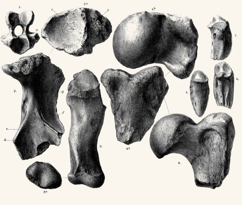
Bones of giant land tortoises from Maltese caves
Bones of giant land tortoises from Maltese caves, drawn for the Quarterly Journal of the Geological Society, 1877. Public domain

Dwejra: Malta's first geological park

In February 2026 the Environment and Resources Authority proposed the Dwejra Protection and Management Regulations, making the Dwejra–Qawra area of western Gozo Malta's first Site of Geological Importance. Its cliffs, sea stacks, the Inland Sea, valleys and reefs would be protected, with limits on digging, dumping, taking fossils, off-roading, light and noise, and fires in sensitive areas. A Dwejra Steering Committee would help ERA look after the site. The public consultation closed on 3 March 2026.

Dwejra and the Azure Window, drawn by Edward Lear
Dwejra with the Azure Window still standing, drawn by Edward Lear in the 19th century. Public domain
Where the Azure Window stood, five years after it fell
Where the Azure Window stood, five years after it fell in March 2017. Photo: Bis-Serjetà, CC0
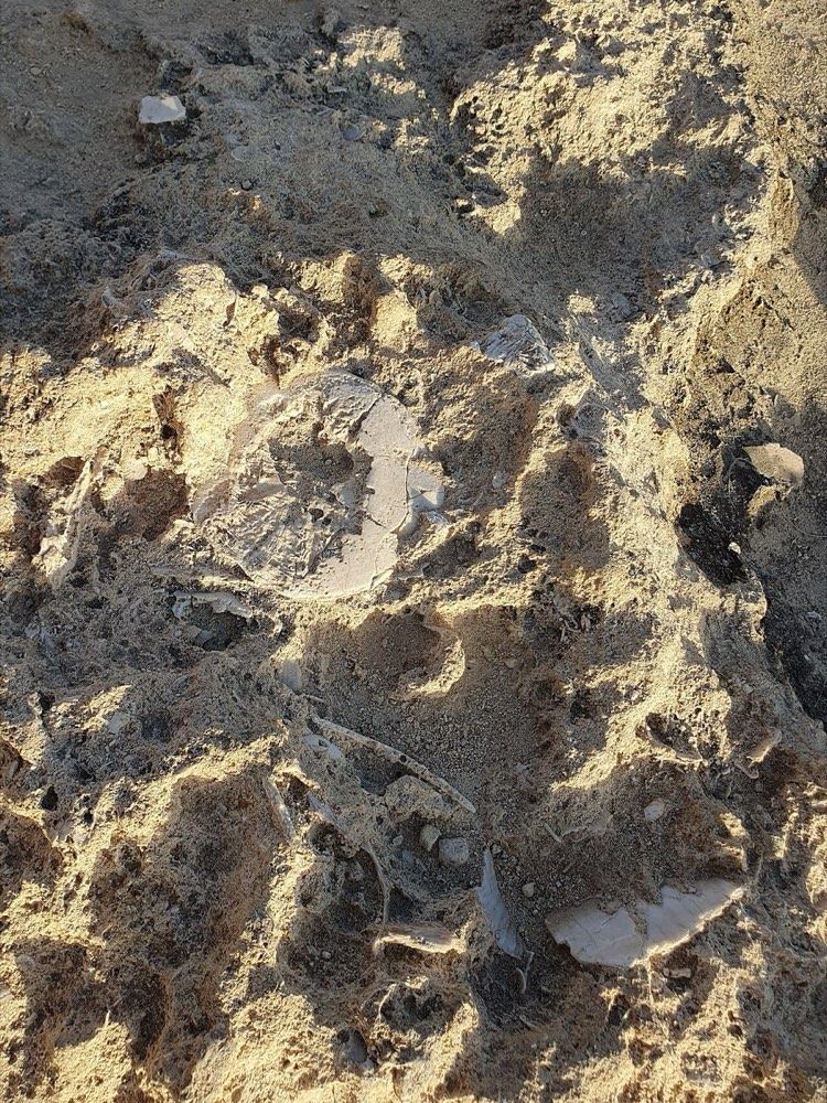
Fossil sand dollars in the rock at Dwejra
Fossil sand dollars (Scutella subrotunda) in the rock at Dwejra, the kind of find the new rules protect. Photo: Qasinka, CC0

The regulations and consultation (ERA) ↗ · TVMnews report ↗ · Aqra bil-Malti ↗

Geology in the news

News

Geologist says Malta's approach to rockfall risk is 'reactive, not proactive'

The Malta Independent · 5 July 2026

Peter Gatt, president of the Malta Chamber of Geologists, argues that Malta needs a national geological service to manage rockfall risk before accidents happen, not after.

Opinion

A modern state needs a geological survey

MaltaToday (editorial) · 1 July 2026

Written after a fatal rock collapse at Comino, the editorial calls for a national geological survey to watch over coastal hazards and public safety.

News

Malta's 'massive' continental shelf remains largely unexplored

The Malta Independent · 9 March 2026

Peter Gatt notes that only 13 wells have been drilled on the Maltese continental shelf since the 1950s, so most of what lies under the seabed is still unknown.

News

Geologist sounds alarm: 'We are building on unsafe ground'

The Malta Independent · 8 March 2026

The Chamber of Geologists' president warns that building rules in Malta lack geological checks and lag behind European standards.

News

Malta's first-ever geological park at Dwejra-Qawra

TVMnews · 3 February 2026

ERA launches a public consultation on rules that would make Dwejra–Qawra in Gozo a protected Site of Geological Importance.

Maps

New geological map of the Maltese Islands published

British Geological Survey · 19 December 2022

The first full revision of the map in almost 30 years, surveyed in 2021–22 at 1:10,000 for the Continental Shelf Department and free to explore online.

News and other content on this site are compiled from the sources cited on each item and summarised in our own words. We do not claim the original reporting or research as our own: follow the source link for the full original. Information may be incomplete or out of date, so check with the source or the authorities before relying on it.

© 2026 Today.mt. All rights reserved. Photographs and other media remain the property of their owners and are used under the licences credited on the Photo credits page. Names and quotations belong to their respective sources. Photo credits

No accounts, no tracking. Photos and some content are placeholders for internal review.